
Tschars topographic map
Interactive map
Click on the map to display elevation.
About this map
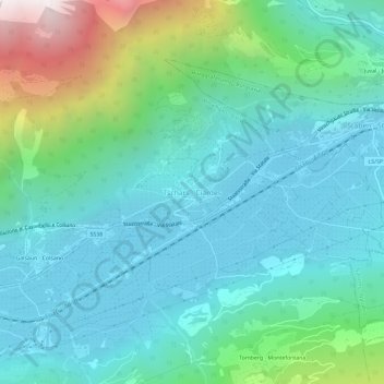
Name: Tschars topographic map, elevation, terrain.
Average elevation: 914 m
Minimum elevation: 542 m
Maximum elevation: 2,285 m
Tschars befindet sich auf der orographisch linken Seite des Etschtals auf einer Meereshöhe von ca. 636 m s.l.m. Das Dorf liegt in Hanglage am Fuße des Sonnenbergs.