Geolocate

Sukanagara topographic map

Click on the map to display elevation.

About this map

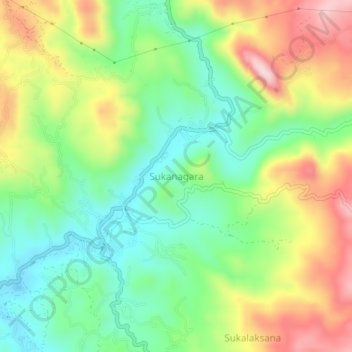
Name: Sukanagara topographic map, elevation, terrain.

Location: Sukanagara, Cianjur, West Java, Java, Indonesia (-7.11316 107.11769 -7.07316 107.15769)

Average elevation: 988 m

Minimum elevation: 854 m

Maximum elevation: 1,189 m

Gear up for your next adventure:

🎒Tactical Waist Packs - Quick access to your compass, phone, and snacks while walking
🧦Hiking Socks - Comfortable socks for long hikes
☀️Portable Solar Chargers - High-efficiency panels to hang on your backpack while walking
🧤Hiking Gloves - Protective gloves for outdoor use
📻Handheld UHF Radios - Critical communication for groups in the Australian outback

As an Amazon Associate, this site earns from qualifying purchases at no extra cost to you.