Geolocate

Candelas topographic map

Click on the map to display elevation.

About this map

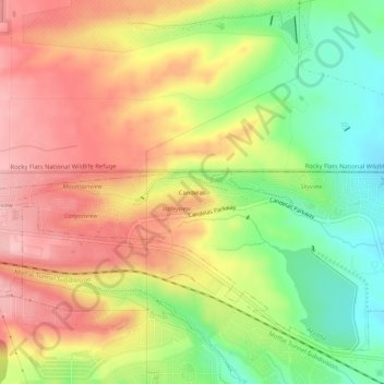
Name: Candelas topographic map, elevation, terrain.

Location: Candelas, Arvada, Jefferson County, Colorado, 80007, United States (39.84848 -105.21726 39.88848 -105.17726)

Average elevation: 1,801 m

Minimum elevation: 1,717 m

Maximum elevation: 1,875 m

Other topographic maps

Click on a map to view its topography, its elevation and its terrain.

Gear up for your next adventure:

🔦Powerful LED Headlamps - Hands-free lighting for night navigation and setting up camp after dark
🛰️Handheld GPS Units - Rugged GPS devices for tracking coordinates and elevation in the Australian bush
🏕️Camping Gear - Essential camping equipment
🧥Softshell Jackets - Flexible outdoor jackets
🥾Hiking Boots - Durable hiking boots for trails and rough terrain

As an Amazon Associate, this site earns from qualifying purchases at no extra cost to you.