Geolocate

Ferme-Neuve topographic map

Click on the map to display elevation.

About this map
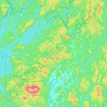
Name: Ferme-Neuve topographic map, elevation, terrain.

Location: Ferme-Neuve, Antoine-Labelle, Laurentides, Quebec, Canada (46.61483 -75.74728 47.06681 -75.29232)

Average elevation: 306 m

Minimum elevation: 208 m

Maximum elevation: 762 m

Gear up for your next adventure:

🚴Cycling Backpacks - Backpacks for cyclists
🧥Softshell Jackets - Flexible outdoor jackets
🔋Solar Power Banks - Solar chargers for outdoors
🧯Animal Deterrent Spray - Safety spray for wildlife
🧺Fast-Dry Microfiber Towels - Large towels that pack down to the size of an orange

As an Amazon Associate, this site earns from qualifying purchases at no extra cost to you.