
St. Georges Channel topographic map
Interactive map
Click on the map to display elevation.
About this map
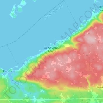
Name: St. Georges Channel topographic map, elevation, terrain.
Average elevation: 60 m
Minimum elevation: -3 m
Maximum elevation: 199 m
Other topographic maps
Click on a map to view its topography, its elevation and its terrain.
Cleveland
Kanada > Neuschottland > Municipality of the County of Richmond
Cleveland, Municipality of the County of Richmond, Richmond County, Neuschottland, Kanada
Average elevation: 40 m