Geolocate

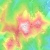
Barile topographic map

Click on the map to display elevation.

About this map

Name: Barile topographic map, elevation, terrain.

Location: Barile, Potenza, Basilicata, 85022, Italy (40.92841 15.64807 40.97464 15.74198)

Average elevation: 598 m

Minimum elevation: 255 m

Maximum elevation: 1,300 m

Other topographic maps

Click on a map to view its topography, its elevation and its terrain.
Viadotto Pantanelle

Italy > Basilicata > Potenza > Nemoli

Average elevation: 1,685 m

Gear up for your next adventure:

🍶Collapsible Water Bottles - Save space in your pack as you consume your water supply
🕯️Emergency Whistles - Safety whistles for hiking
📟Satellite Messengers - Two-way satellite communication to stay in touch beyond the cellular grid
🔪Camping Knives - Multi-purpose outdoor knives
🎒Ultralight Backpacks - Lightweight packs for long hikes

As an Amazon Associate, this site earns from qualifying purchases at no extra cost to you.