
Thank you for supporting this site ❤️
Make a donation
Make a donation
Gear up for your next adventure:
As an Amazon Associate, this site earns from qualifying purchases at no extra cost to you.
Djerem topographic map
Click on the map to display elevation.
Thank you for supporting this site ❤️
Make a donation
Make a donation
Gear up for your next adventure:
As an Amazon Associate, this site earns from qualifying purchases at no extra cost to you.
About this map
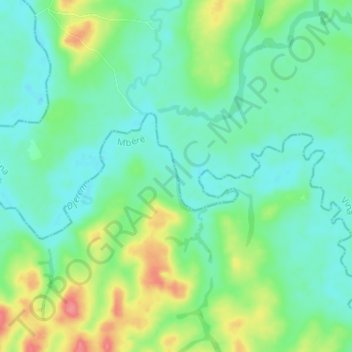
Name: Djerem topographic map, elevation, terrain.
Location: Djerem, Nyambaka, Vina, Adamawa, Cameroon (6.57728 13.52859 6.60013 13.59305)
Average elevation: 870 m
Minimum elevation: 849 m
Maximum elevation: 919 m
Thank you for supporting this site ❤️
Make a donation
Make a donation
Gear up for your next adventure:
As an Amazon Associate, this site earns from qualifying purchases at no extra cost to you.