
La Larga topographic map
Interactive map
Click on the map to display elevation.
About this map
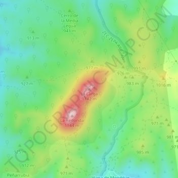
Name: La Larga topographic map, elevation, terrain.
Location: La Larga, Trillo, Guadalajara, Castilla-La Mancha, España (40.66310 -2.56656 40.66320 -2.56646)
Average elevation: 933 m
Minimum elevation: 822 m
Maximum elevation: 1,140 m