
Oberwil topographic map
Interactive map
Click on the map to display elevation.
About this map
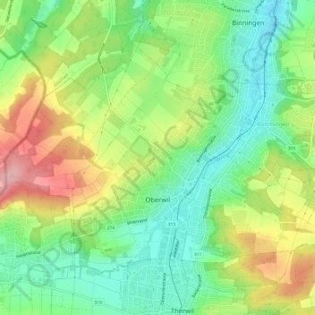
Name: Oberwil topographic map, elevation, terrain.
Location: Oberwil, Bezirk Arlesheim, Bazel-Land, 4104, Zwitserland (47.50420 7.52347 47.53401 7.58368)
Average elevation: 343 m
Minimum elevation: 284 m
Maximum elevation: 430 m
Other topographic maps
Click on a map to view its topography, its elevation and its terrain.
Münchenstein
Zwitserland > Bazel-Land > Bezirk Arlesheim
Münchenstein, Bezirk Arlesheim, Bazel-Land, Zwitserland
Average elevation: 328 m