
Almeida topographic map
Interactive map
Click on the map to display elevation.
About this map
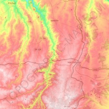
Name: Almeida topographic map, elevation, terrain.
Location: Almeida, Guarda, Centro, Portugal (40.47668 -7.05183 40.78342 -6.79401)
Average elevation: 724 m
Minimum elevation: 468 m
Maximum elevation: 857 m