Geolocate

Johnston topographic map

Click on the map to display elevation.

About this map

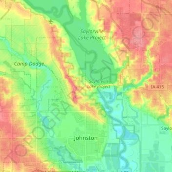
Name: Johnston topographic map, elevation, terrain.

Location: Johnston, Polk County, Iowa, United States (41.65268 -93.78511 41.75394 -93.66455)

Average elevation: 267 m

Minimum elevation: 236 m

Maximum elevation: 308 m

Gear up for your next adventure:

🧣Merino Neck Gaiters - Versatile headwear for warmth, sun protection, or dust filtering
🔥Ferrocerium Rod Fire Starters - Reliable fire lighting in wet or windy conditions without matches
🧥Softshell Jackets - Flexible outdoor jackets
🐍Australian Snake Bite Kits - Specific pressure immobilization bandages for Australian venomous snakes
🌧️Rain Jackets - Waterproof jackets for hiking

As an Amazon Associate, this site earns from qualifying purchases at no extra cost to you.