
Oley topographic map
Interactive map
Click on the map to display elevation.
About this map
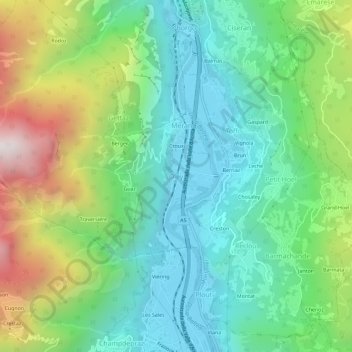
Name: Oley topographic map, elevation, terrain.
Location: Oley, Montjovet, Aosta Valley, 11029, Italy (45.68429 7.64663 45.72429 7.68663)
Average elevation: 809 m
Minimum elevation: 368 m
Maximum elevation: 1,786 m