
Uyurpampa topographic map
Interactive map
Click on the map to display elevation.
About this map
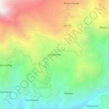
Name: Uyurpampa topographic map, elevation, terrain.
Location: Uyurpampa, Incahuasi, Ferreñafe, Lambayeque, Perú (-6.23938 -79.38079 -6.19938 -79.34079)
Average elevation: 2,907 m
Minimum elevation: 2,297 m
Maximum elevation: 3,764 m
Other topographic maps
Click on a map to view its topography, its elevation and its terrain.
Ayamachay
Perú > Lambayeque > Incahuasi
Ayamachay, Incahuasi, Ferreñafe, Lambayeque, Perú
Average elevation: 2,825 m
Refugio de Vida Silvestre Laquipampa
Perú > Lambayeque > Incahuasi
Refugio de Vida Silvestre Laquipampa, LA-103, Incahuasi, Ferreñafe, Lambayeque, Perú
Average elevation: 1,051 m
Hacienda Janque
Perú > Lambayeque > Incahuasi > Hacienda Janque
Hacienda Janque, Incahuasi, Provincia de Ferreñafe, Lambayeque, Perú
Average elevation: 2,247 m