
Knittelfeld topographic map
Interactive map
Click on the map to display elevation.
About this map
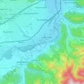
Name: Knittelfeld topographic map, elevation, terrain.
Location: Knittelfeld, Murtal, Estiria, 8720, Austria (47.17058 14.79977 47.22832 14.86005)
Average elevation: 730 m
Minimum elevation: 614 m
Maximum elevation: 1,272 m