
Thenford topographic map
Click on the map to display elevation.
About this map
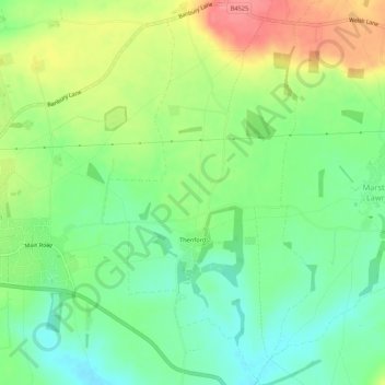
Name: Thenford topographic map, elevation, terrain.
Location: Thenford, West Northamptonshire, England, United Kingdom (52.06016 -1.25621 52.09299 -1.22716)
Average elevation: 134 m
Minimum elevation: 100 m
Maximum elevation: 185 m
Other topographic maps
Click on a map to view its topography, its elevation and its terrain.
Lower Thorpe
United Kingdom > England > West Northamptonshire > Thorpe Mandeville
Average elevation: 154 m
Ravensthorpe Reservoir
United Kingdom > England > West Northamptonshire > Coton
Average elevation: 131 m