
Thank you for supporting this site ❤️
Make a donation
Make a donation
Gear up for your next adventure:
As an Amazon Associate, this site earns from qualifying purchases at no extra cost to you.
Markanda topographic map
Click on the map to display elevation.
Thank you for supporting this site ❤️
Make a donation
Make a donation
Gear up for your next adventure:
As an Amazon Associate, this site earns from qualifying purchases at no extra cost to you.
About this map
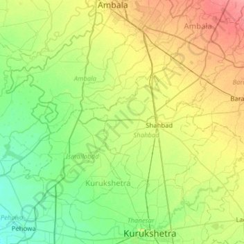
Name: Markanda topographic map, elevation, terrain.
Location: Markanda, Shahbad, Kurukshetra, Haryana, 136130, India (30.06508 76.51687 30.27850 77.02908)
Average elevation: 263 m
Minimum elevation: 243 m
Maximum elevation: 300 m
Thank you for supporting this site ❤️
Make a donation
Make a donation
Gear up for your next adventure:
As an Amazon Associate, this site earns from qualifying purchases at no extra cost to you.