
Gaggera topographic map
Interactive map
Click on the map to display elevation.
About this map
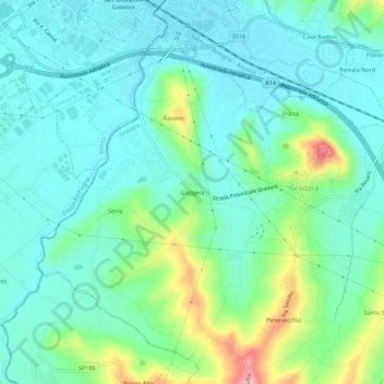
Name: Gaggera topographic map, elevation, terrain.
Location: Gaggera, Gradara, Pesaro e Urbino, Marche, 61012, Italia (43.91835 12.73508 43.95835 12.77508)
Average elevation: 40 m
Minimum elevation: 5 m
Maximum elevation: 147 m