
Tombstone topographic map
Interactive map
Click on the map to display elevation.
About this map
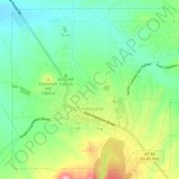
Name: Tombstone topographic map, elevation, terrain.
Average elevation: 1,364 m
Minimum elevation: 1,307 m
Maximum elevation: 1,468 m
Other topographic maps
Click on a map to view its topography, its elevation and its terrain.
Sierra Vista
Verenigde Staten > Arizona > Cochise County
Sierra Vista, Cochise County, Arizona, Verenigde Staten
Average elevation: 1,507 m