
Yongun-dong topographic map
Interactive map
Click on the map to display elevation.
About this map
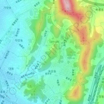
Name: Yongun-dong topographic map, elevation, terrain.
Location: Yongun-dong, Dong-gu, Daejeon, South Korea (36.32200 127.44748 36.34525 127.47200)
Average elevation: 126 m
Minimum elevation: 59 m
Maximum elevation: 297 m