Geolocate

Morong topographic map

Click on the map to display elevation.

About this map

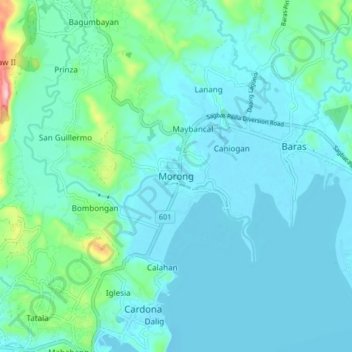
Name: Morong topographic map, elevation, terrain.

Location: Morong, Rizal, Calabarzon, 1960, Philippines (14.47514 121.19809 14.55514 121.27809)

Average elevation: 37 m

Minimum elevation: -3 m

Maximum elevation: 260 m

Gear up for your next adventure:

🎨Portable Watercolor Kits - Paint the landscapes and topographic views you discover
🐍Australian Snake Bite Kits - Specific pressure immobilization bandages for Australian venomous snakes
👕UPF 50+ Sun Shirts - Essential protection against the harsh Australian sun during field work
🎽Base Layers - Thermal base layers
Ultralight Solo Tents - Compact shelters for multi-day topographic surveying expeditions

As an Amazon Associate, this site earns from qualifying purchases at no extra cost to you.