
Thank you for supporting this site ❤️
Make a donation
Make a donation
Gear up for your next adventure:
As an Amazon Associate, this site earns from qualifying purchases at no extra cost to you.
Fustat topographic map
Click on the map to display elevation.
Thank you for supporting this site ❤️
Make a donation
Make a donation
Gear up for your next adventure:
As an Amazon Associate, this site earns from qualifying purchases at no extra cost to you.
About this map
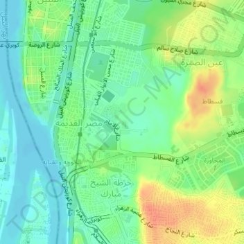
Name: Fustat topographic map, elevation, terrain.
Location: Fustat, Masr Al-Qadima, El Sheikh Mubarak, Cairo, Egypt (30.00358 31.22954 30.01115 31.24117)
Average elevation: 29 m
Minimum elevation: 12 m
Maximum elevation: 56 m
Thank you for supporting this site ❤️
Make a donation
Make a donation
Gear up for your next adventure:
As an Amazon Associate, this site earns from qualifying purchases at no extra cost to you.