
Lake Worth Beach topographic map
Interactive map
Click on the map to display elevation.
About this map
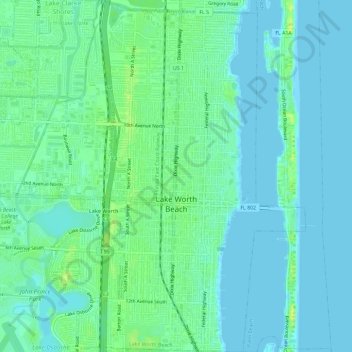
Name: Lake Worth Beach topographic map, elevation, terrain.
Average elevation: 6 m
Minimum elevation: -3 m
Maximum elevation: 17 m
Lake Worth Beach is located at 26°37′11″N 80°3′31″W / 26.61972°N 80.05861°W / 26.61972; -80.05861, bordering West Palm Beach to the north, Lake Clarke Shores to the northeast, and Lantana to the south. The municipal beach section of the city borders Palm Beach, while Lake Worth Beach is also located just east of Palm Springs. Lake Worth Beach is located about 64 miles (103 km) north of Miami. According to the United States Census Bureau, the city has a total area of 6.81 square miles (18 km2), of which 5.89 square miles (15 km2) is land and 0.92 square miles (2 km2) (13.51%) is water. The average elevation of Lake Worth Beach is 16 ft (4.9 m).