
Parque Las Palmas topographic map
Interactive map
Click on the map to display elevation.
About this map
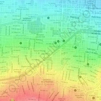
Name: Parque Las Palmas topographic map, elevation, terrain.
Average elevation: 87 m
Minimum elevation: 50 m
Maximum elevation: 131 m
Other topographic maps
Click on a map to view its topography, its elevation and its terrain.
Distrito III
Nicaragua > Managua > Managua (Municipio)
Distrito III, Managua (Municipio), Managua, Nicaragua
Average elevation: 308 m