Geolocate

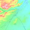
Valentine topographic map

Click on the map to display elevation.

About this map

Name: Valentine topographic map, elevation, terrain.

Location: Valentine, Jeff Davis County, Texas, United States (30.58363 -104.50376 30.59614 -104.48909)

Average elevation: 1,352 m

Minimum elevation: 1,340 m

Maximum elevation: 1,366 m

Other topographic maps

Click on a map to view its topography, its elevation and its terrain.
Fort Davis

United States > Texas > Jeff Davis County

Average elevation: 1,526 m

Fort Davis

United States > Texas > Jeff Davis County

Fort Davis has the highest elevation above sea level of any county seat in Texas; the elevation is 4,900 feet (1,500 m).

Average elevation: 1,526 m

Fort Davis

United States > Texas > Jeff Davis County

Average elevation: 1,526 m

Fort Davis

United States > Texas > Jeff Davis County

Average elevation: 1,526 m

Gear up for your next adventure:

🏕️Camping Gear - Essential camping equipment
🧥Packable Rain Jackets - Breathable waterproof layers for unpredictable mountain weather
🧤Hiking Gloves - Protective gloves for outdoor use
🧭Military Style Lensatic Compass - Durable sighting compasses for advanced land navigation and surveying
🎒Ultralight Backpacks - Lightweight packs for long hikes

As an Amazon Associate, this site earns from qualifying purchases at no extra cost to you.