
Villa Montes topographic map
Interactive map
Click on the map to display elevation.
About this map
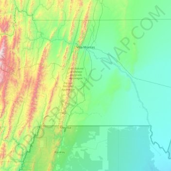
Name: Villa Montes topographic map, elevation, terrain.
Location: Villa Montes, Gran Chaco, Tarija, Bolivia (-22.25140 -63.98998 -20.98951 -62.25794)
Average elevation: 674 m
Minimum elevation: 253 m
Maximum elevation: 2,901 m
Other topographic maps
Click on a map to view its topography, its elevation and its terrain.
El Trece
Bolivia > Tarija > Villa Montes > El Trece
El Trece, Villa Montes, Gran Chaco, Tarija, Bolivia
Average elevation: 322 m