Geolocate

Doddinghurst topographic map

Click on the map to display elevation.

About this map

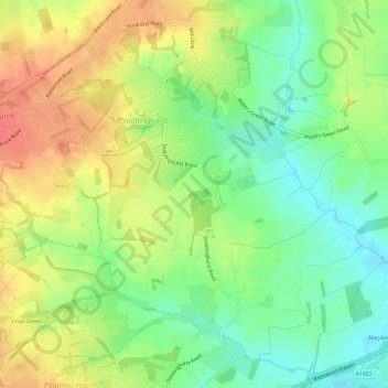
Name: Doddinghurst topographic map, elevation, terrain.

Location: Doddinghurst, Brentwood, Essex, England, United Kingdom (51.64296 0.27172 51.67405 0.33194)

Average elevation: 80 m

Minimum elevation: 55 m

Maximum elevation: 106 m

Other topographic maps

Click on a map to view its topography, its elevation and its terrain.

Hook End

United Kingdom > England > Essex > Brentwood > Doddinghurst

Average elevation: 82 m

Gear up for your next adventure:

🏃Compression Recovery Socks - Reduce leg fatigue after heavy days of elevation gain
🔭Compact Hiking Binoculars - Lightweight optics for scouting routes or birdwatching
🦘Outback Survival Gear - Essential gear for Australian outback
🎽Hiking Clothing - Breathable clothing for hiking
🛌Sleeping Bags - Sleeping bags for outdoor camping

As an Amazon Associate, this site earns from qualifying purchases at no extra cost to you.