Geolocate

Paniman topographic map

Click on the map to display elevation.

About this map
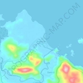
Name: Paniman topographic map, elevation, terrain.

Location: Paniman, Caramoan, Camarines Sur, Bicol Region, 4429, Philippines (13.79022 123.85541 13.83022 123.89541)

Average elevation: 28 m

Minimum elevation: -3 m

Maximum elevation: 254 m

Other topographic maps

Click on a map to view its topography, its elevation and its terrain.

Lahuy Island

Philippines > Camarines Sur > Caramoan

Average elevation: 7 m

Cotivas Island

Philippines > Camarines Sur > Caramoan

Average elevation: 1 m

Banana Island

Philippines > Camarines Sur > Caramoan > Bikal

Average elevation: 6 m

Gear up for your next adventure:

🧦Hiking Socks - Comfortable socks for long hikes
🧤Thermal Hiking Gloves - Keep your hands warm and functional during high-altitude winter treks
🏃Compression Recovery Socks - Reduce leg fatigue after heavy days of elevation gain
🎽Hiking Clothing - Breathable clothing for hiking
👖Convertible Hiking Trousers - Zip-off legs to adapt to changing temperatures throughout the day

As an Amazon Associate, this site earns from qualifying purchases at no extra cost to you.