
Le Petit Val topographic map
Interactive map
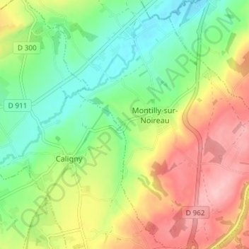
Click on the map to display elevation.
About this map
Name: Le Petit Val topographic map, elevation, terrain.
Average elevation: 148 m
Minimum elevation: 82 m
Maximum elevation: 236 m
Other topographic maps
Click on a map to view its topography, its elevation and its terrain.
La Maillardière
France > Normandie > Orne > Montilly-sur-Noireau
La Maillardière, Montilly-sur-Noireau, Argentan, Orne, Normandie, France métropolitaine, 61100, France
Average elevation: 128 m