
Ourthe topographic map
Interactive map
Click on the map to display elevation.
About this map
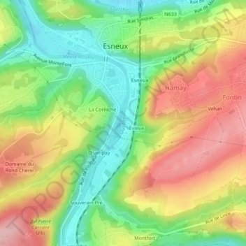
Name: Ourthe topographic map, elevation, terrain.
Location: Ourthe, Champay, Esneux, Luik, Wallonië, 4130, België (50.52285 5.56774 50.52739 5.57035)
Average elevation: 154 m
Minimum elevation: 75 m
Maximum elevation: 241 m