Geolocate

Culpeper topographic map

Click on the map to display elevation.

About this map
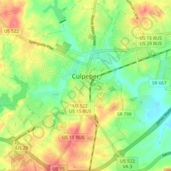
Name: Culpeper topographic map, elevation, terrain.

Location: Culpeper, Culpeper County, Virginia, 22701, United States (38.44113 -78.03194 38.49575 -77.95625)

Average elevation: 131 m

Minimum elevation: 95 m

Maximum elevation: 231 m

Other topographic maps

Click on a map to view its topography, its elevation and its terrain.

Rapidan

United States > Virginia > Culpeper County

Average elevation: 105 m

Rixeyville

United States > Virginia > Culpeper County

Average elevation: 119 m

Rapidan

United States > Virginia > Culpeper County

Average elevation: 105 m

Gear up for your next adventure:

🔑Heavy Duty Carabiners - Secure gear to the outside of your pack for easy access
🦟Heavy Duty Insect Repellent - Essential protection against flies, mozzies, and march flies
🚴Cycling Backpacks - Backpacks for cyclists
🔋Solar Power Banks - Solar chargers for outdoors
🏃Compression Recovery Socks - Reduce leg fatigue after heavy days of elevation gain

As an Amazon Associate, this site earns from qualifying purchases at no extra cost to you.