
Cárdenas topographic map
Interactive map
Click on the map to display elevation.
About this map
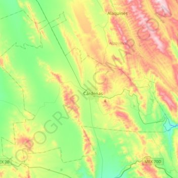
Name: Cárdenas topographic map, elevation, terrain.
Location: Cárdenas, San Luis Potosí, México (21.88431 -99.80942 22.13079 -99.50455)
Average elevation: 1,250 m
Minimum elevation: 951 m
Maximum elevation: 1,754 m