
서초구 topographic map
Interactive map
Click on the map to display elevation.
About this map
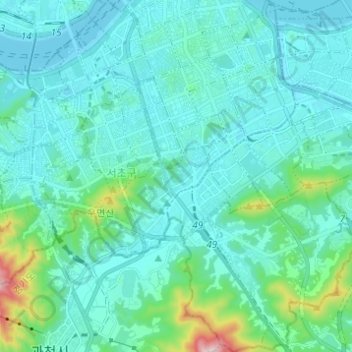
Name: 서초구 topographic map, elevation, terrain.
Location: 서초구, Séoul, Corée du Sud (37.42854 126.98055 37.52588 127.09645)
Average elevation: 75 m
Minimum elevation: 3 m
Maximum elevation: 544 m