
Emily topographic map
Interactive map
Click on the map to display elevation.
About this map
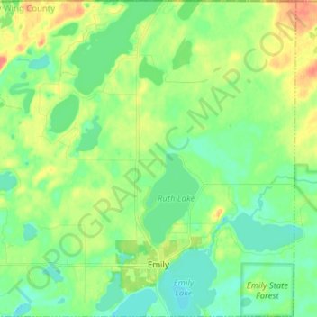
Name: Emily topographic map, elevation, terrain.
Location: Emily, Crow Wing County, Minnesota, 56447, United States (46.71656 -94.02992 46.80365 -93.90266)
Average elevation: 393 m
Minimum elevation: 377 m
Maximum elevation: 422 m