
Pine Hill topographic map
Interactive map
Click on the map to display elevation.
About this map
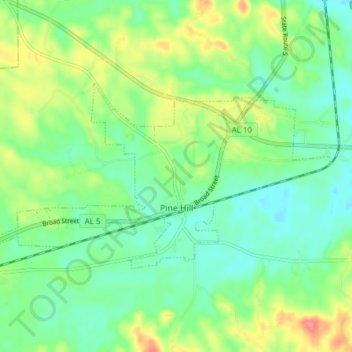
Name: Pine Hill topographic map, elevation, terrain.
Location: Pine Hill, Wilcox County, Alabama, 36769, United States (31.96837 -87.63136 32.00270 -87.55458)
Average elevation: 42 m
Minimum elevation: 17 m
Maximum elevation: 90 m
Other topographic maps
Click on a map to view its topography, its elevation and its terrain.