Geolocate

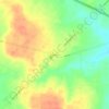
Van topographic map

Click on the map to display elevation.

About this map

Name: Van topographic map, elevation, terrain.

Location: Van, Van Zandt County, Texas, 75790, United States (32.50500 -95.65415 32.53915 -95.61904)

Average elevation: 152 m

Minimum elevation: 136 m

Maximum elevation: 165 m

Other topographic maps

Click on a map to view its topography, its elevation and its terrain.

Ben Wheeler

United States > Texas > Van Zandt County

Average elevation: 165 m

Colfax

United States > Texas > Van Zandt County

Average elevation: 170 m

Martins Mill

United States > Texas > Van Zandt County

Average elevation: 157 m

Gear up for your next adventure:

🏫Topographic World Globes - 3D physical relief globes to understand global geography
🧣Merino Neck Gaiters - Versatile headwear for warmth, sun protection, or dust filtering
🥾Heavy Duty Hiking Boots - Ankle-supporting boots for carrying heavy packs on steep contours
📡Portable Emergency Radios - Stay informed about weather warnings and bushfire alerts
🎽Hiking Clothing - Breathable clothing for hiking

As an Amazon Associate, this site earns from qualifying purchases at no extra cost to you.