
Juan Fernández Islands topographic map
Interactive map
Click on the map to display elevation.
About this map
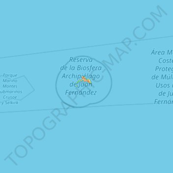
Name: Juan Fernández Islands topographic map, elevation, terrain.
Average elevation: 0 m
Minimum elevation: 0 m
Maximum elevation: 801 m
Alejandro Selkirk is the largest of the Juan Fernández Islands at 49.5 km2 (19.1 sq mi), and its highest peak, Cerro de Los Inocentes, is also the highest point of the archipelago at 1,268 m (4,160 ft). The island's population was 57 in 2012. Robinson Crusoe is the second largest island in the archipelago at 47.9 km2 (18 sq mi); its highest peak, El Yunque, is 915 m (3,002 ft). The population of Robinson Crusoe was 843 in 2012. Santa Clara is 2.2 km2 (0.8 sq mi) in area and reaches a height of 375 m (1,230 ft). Santa Clara is uninhabited. The maximum elevations of Juan Fernández, 915 m (3,002 ft) for Robinson Crusoe and 1,329 m (4,360 ft) for Alejandro Selkirk, respectively, are high enough to cause the phenomenon known as Kármán vortex street, which can be seen from space.