
"Золотая миля" topographic map
Interactive map
Click on the map to display elevation.
About this map
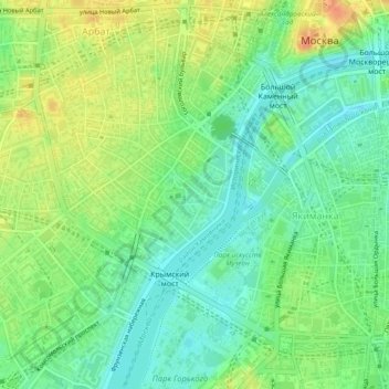
Name: "Золотая миля" topographic map, elevation, terrain.
Average elevation: 135 m
Minimum elevation: 118 m
Maximum elevation: 159 m
Other topographic maps
Click on a map to view its topography, its elevation and its terrain.
Римский дворик
Римский дворик, 38, Arbat District, Moscow, Central Federal District, 121019, Russia
Average elevation: 145 m
Catherine Park
Catherine Park, Meshchansky District, Moscow, Central Federal District, Russia
Average elevation: 161 m
Zaryadye park
Zaryadye park, Kitay-gorod, Tverskoy District, Moscow, Central Federal District, Russia
Average elevation: 141 m