
Río Yavarí topographic map
Interactive map
Click on the map to display elevation.
About this map
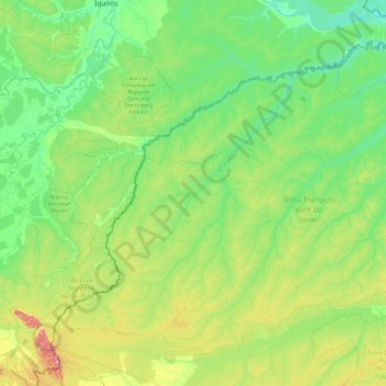
Name: Río Yavarí topographic map, elevation, terrain.
Location: Río Yavarí, Mariscal Ramón Castilla, Loreto, Perú (-7.11306 -73.79842 -4.12640 -69.99182)
Average elevation: 144 m
Minimum elevation: 64 m
Maximum elevation: 694 m
Other topographic maps
Click on a map to view its topography, its elevation and its terrain.