
Hosszúhetény topographic map
Interactive map
Click on the map to display elevation.
About this map
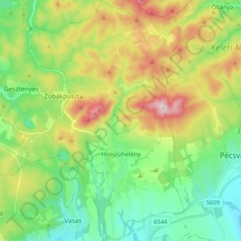
Name: Hosszúhetény topographic map, elevation, terrain.
Average elevation: 341 m
Minimum elevation: 163 m
Maximum elevation: 673 m
Other topographic maps
Click on a map to view its topography, its elevation and its terrain.
Gordisa
Gordisa, Siklósi járás, Baranya megye, Transdanubie méridionale, Transdanubie, 7853, Hongrie
Average elevation: 91 m
Kémes
Kémes, Siklósi járás, Baranya megye, Transdanubie méridionale, Transdanubie, 7843, Hongrie
Average elevation: 95 m
Köblény
Hongrie > Baranya megye > Köblény
Köblény, Komlói járás, Baranya megye, Transdanubie méridionale, Transdanubie, Hongrie
Average elevation: 205 m
Mohácsi járás
Mohácsi járás, Baranya megye, Transdanubie méridionale, Transdanubie, Hongrie
Average elevation: 119 m