
Serantes topographic map
Interactive map
Click on the map to display elevation.
About this map
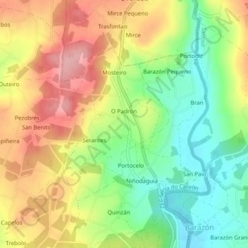
Name: Serantes topographic map, elevation, terrain.
Average elevation: 384 m
Minimum elevation: 317 m
Maximum elevation: 456 m
Other topographic maps
Click on a map to view its topography, its elevation and its terrain.
Río Furelos
España > Galicia > Tierra de Melide > Melide > Piñor
Río Furelos, Piñor, Furelos, Melide, Tierra de Melide, La Coruña, Galicia, 15809, España
Average elevation: 424 m