
Sherwood topographic map
Interactive map
Click on the map to display elevation.
About this map
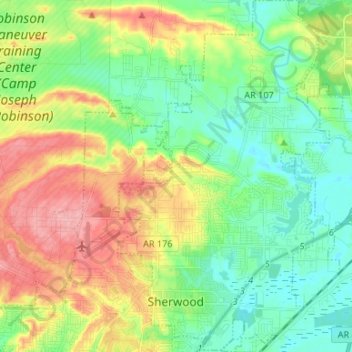
Name: Sherwood topographic map, elevation, terrain.
Location: Sherwood, Pulaski County, Arkansas, 72120, VS (34.79962 -92.24601 34.88373 -92.17219)
Average elevation: 109 m
Minimum elevation: 68 m
Maximum elevation: 178 m