Geolocate

Gainesville topographic map

Click on the map to display elevation.

About this map

Name: Gainesville topographic map, elevation, terrain.

Location: Gainesville, Prince William County, Virginia, 20155, United States (38.76327 -77.66639 38.82431 -77.57234)

Average elevation: 99 m

Minimum elevation: 64 m

Maximum elevation: 132 m

Other topographic maps

Click on a map to view its topography, its elevation and its terrain.
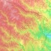
Antioch

United States > Virginia > Prince William County

Average elevation: 199 m

Gear up for your next adventure:

🔑Heavy Duty Carabiners - Secure gear to the outside of your pack for easy access
📍Handheld GPS - GPS devices for hiking and navigation
🧥Down Jackets - Insulated jackets for cold weather
🛌Sleeping Mats - Insulated mats for camping comfort
🌬️Windbreaker Jackets - Wind protection jackets

As an Amazon Associate, this site earns from qualifying purchases at no extra cost to you.