Geolocate

Lott topographic map

Click on the map to display elevation.

About this map

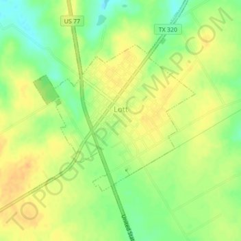
Name: Lott topographic map, elevation, terrain.

Location: Lott, Falls County, Texas, United States (31.18994 -97.04597 31.21953 -97.02195)

Average elevation: 163 m

Minimum elevation: 144 m

Maximum elevation: 176 m

Gear up for your next adventure:

👕UPF 50+ Sun Shirts - Essential protection against the harsh Australian sun during field work
🧰Survival Kits - Essential survival gear
📱Shockproof Phone Cases - Extra protection for your smartphone against drops on rocky terrain
🍳Ultralight Camping Stoves - Boil water quickly for meals using minimal fuel
🥤Outdoor Water Bottles - Reusable bottles for outdoor activities

As an Amazon Associate, this site earns from qualifying purchases at no extra cost to you.