
Los Chacayes topographic map
Interactive map
Click on the map to display elevation.
About this map
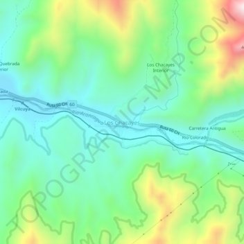
Name: Los Chacayes topographic map, elevation, terrain.
Average elevation: 1,225 m
Minimum elevation: 1,013 m
Maximum elevation: 1,728 m
Other topographic maps
Click on a map to view its topography, its elevation and its terrain.
El Membrillo
Chile > Región de Valparaíso > Provincia de Los Andes > San Esteban
El Membrillo, San Esteban, Provincia de Los Andes, Región de Valparaíso, Chile
Average elevation: 867 m