Geolocate

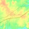
Ranger topographic map

Click on the map to display elevation.

About this map

Name: Ranger topographic map, elevation, terrain.

Location: Ranger, Eastland County, Texas, 76470, United States (32.43691 -98.69959 32.48798 -98.65004)

Average elevation: 455 m

Minimum elevation: 421 m

Maximum elevation: 487 m

Other topographic maps

Click on a map to view its topography, its elevation and its terrain.
Union Center

United States > Texas > Eastland County

Average elevation: 489 m

Olden

United States > Texas > Eastland County

Average elevation: 472 m

Olden

United States > Texas > Eastland County

Average elevation: 472 m

Ranger

United States > Texas > Eastland County

Average elevation: 455 m

Gear up for your next adventure:

🔥Camping Stoves - Portable stoves for outdoor cooking
🛠️Outdoor Repair Kits - Gear repair kits
📡Weather Radios - Emergency weather radios
🥾Heavy Duty Hiking Boots - Ankle-supporting boots for carrying heavy packs on steep contours
👕UPF 50+ Sun Shirts - Essential protection against the harsh Australian sun during field work

As an Amazon Associate, this site earns from qualifying purchases at no extra cost to you.