
Santenoge topographic map
Interactive map
Click on the map to display elevation.
About this map
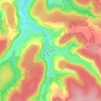
Name: Santenoge topographic map, elevation, terrain.
Average elevation: 423 m
Minimum elevation: 342 m
Maximum elevation: 483 m
Other topographic maps
Click on a map to view its topography, its elevation and its terrain.
Étang de la Juchère
France > Grand Est > Haute-Marne > Villars-Santenoge > Villars-Montroyer
Étang de la Juchère, D 118, Villars-Montroyer, Villars-Santenoge, Langres, Haute-Marne, Grand Est, France métropolitaine, 52160, France
Average elevation: 404 m
Villars-Montroyer
France > Grand Est > Haute-Marne > Villars-Santenoge
Villars-Montroyer, Villars-Santenoge, Langres, Haute-Marne, Grand Est, France métropolitaine, 52160, France
Average elevation: 404 m