Geolocate

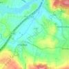
Eichenzell topographic map

Click on the map to display elevation.

About this map

Name: Eichenzell topographic map, elevation, terrain.

Location: Eichenzell, Landkreis Fulda, Hesse, 36124, Germany (50.41308 9.64614 50.51130 9.79039)

Average elevation: 357 m

Minimum elevation: 257 m

Maximum elevation: 562 m

Other topographic maps

Click on a map to view its topography, its elevation and its terrain.
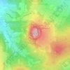
Milseburg

Germany > Hesse > Landkreis Fulda

The Milseburg is an extinct volcano and at 835 metres (2,740 ft) above sea level the second highest elevation in the Hessian part of the Rhön Mountains, Germany. The hill is located east of Fulda, near the villages of Kleinsassen and Danzwiesen. It is a popular destination for hikers and bikers.…

Average elevation: 619 m
Oberbernhards

Germany > Hesse > Landkreis Fulda > Liebhards

Average elevation: 579 m

Erlenhof

Germany > Hesse > Landkreis Fulda

Average elevation: 306 m

Branders

Germany > Hesse > Landkreis Fulda > Buchenau

Average elevation: 344 m

Gear up for your next adventure:

🌿Flora and Fauna Field Guides - Identify the plants and animals you encounter on your route
🩹Blister Prevention Tape - Apply to friction points before they become painful sores
📸Action Cameras - Record your journey across interesting topographic features in 4K
🧭Compass - Navigation compasses for outdoor exploration
🔥Ferrocerium Rod Fire Starters - Reliable fire lighting in wet or windy conditions without matches

As an Amazon Associate, this site earns from qualifying purchases at no extra cost to you.