Geolocate

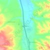
Garryowen topographic map

Click on the map to display elevation.

About this map

Name: Garryowen topographic map, elevation, terrain.

Location: Garryowen, Big Horn County, Montana, 59031, United States (45.50679 -107.43660 45.54679 -107.39660)

Average elevation: 965 m

Minimum elevation: 940 m

Maximum elevation: 1,047 m

Other topographic maps

Click on a map to view its topography, its elevation and its terrain.

Crow Agency

United States > Montana > Big Horn County

Average elevation: 960 m

Lodge Grass

United States > Montana > Big Horn County

Average elevation: 1,038 m

Hardin

United States > Montana > Big Horn County

Average elevation: 886 m

Gear up for your next adventure:

🚗Car Camping Gear - Equipment for vehicle camping
👕UPF 50+ Sun Shirts - Essential protection against the harsh Australian sun during field work
🔋Solar Power Banks - Solar chargers for outdoors
🎒Hiking Backpacks - Backpacks designed for hiking and trekking
📕Hiking Guide Books - Guides for hiking trails

As an Amazon Associate, this site earns from qualifying purchases at no extra cost to you.