Geolocate

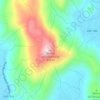
Rio Linhares topographic map

Click on the map to display elevation.

About this map

Other topographic maps

Click on a map to view its topography, its elevation and its terrain.

Praia da Gamboa

Brasil > Santa Catarina > Garopaba

Average elevation: 29 m

Morro da Encantada

Brasil > Santa Catarina > Garopaba

Average elevation: 128 m

Gamboa

Brasil > Santa Catarina > Garopaba

Average elevation: 61 m

Praia do Ouvidor

Brasil > Santa Catarina > Garopaba

Average elevation: 8 m

Ferraz

Brasil > Santa Catarina > Garopaba

Average elevation: 22 m

Praia do Silveira

Brasil > Santa Catarina > Garopaba

Average elevation: 27 m

Gear up for your next adventure:

👟Lightweight Trail Runners - Agile footwear for fast movement over rugged Australian terrain
🔋Solar Power Banks - Charge your phone and GPS using the sun while deep in the bush
🎒Dry Bags - Waterproof bags for outdoor gear
📕Australia Maps - Maps covering Australian regions
🍶Collapsible Water Bottles - Save space in your pack as you consume your water supply

As an Amazon Associate, this site earns from qualifying purchases at no extra cost to you.