
Village of Suffern topographic map
Interactive map
Click on the map to display elevation.
About this map
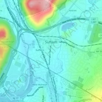
Name: Village of Suffern topographic map, elevation, terrain.
Average elevation: 114 m
Minimum elevation: 77 m
Maximum elevation: 258 m
Other topographic maps
Click on a map to view its topography, its elevation and its terrain.
Fort Clinton
United States > New York > Rockland County > Town of Stony Point
Average elevation: 111 m
Garnerville
United States > New York > Rockland County > Village of West Haverstraw
Average elevation: 80 m
Antrim
United States > New York > Rockland County > Town of Ramapo > Village of Suffern
Average elevation: 140 m